
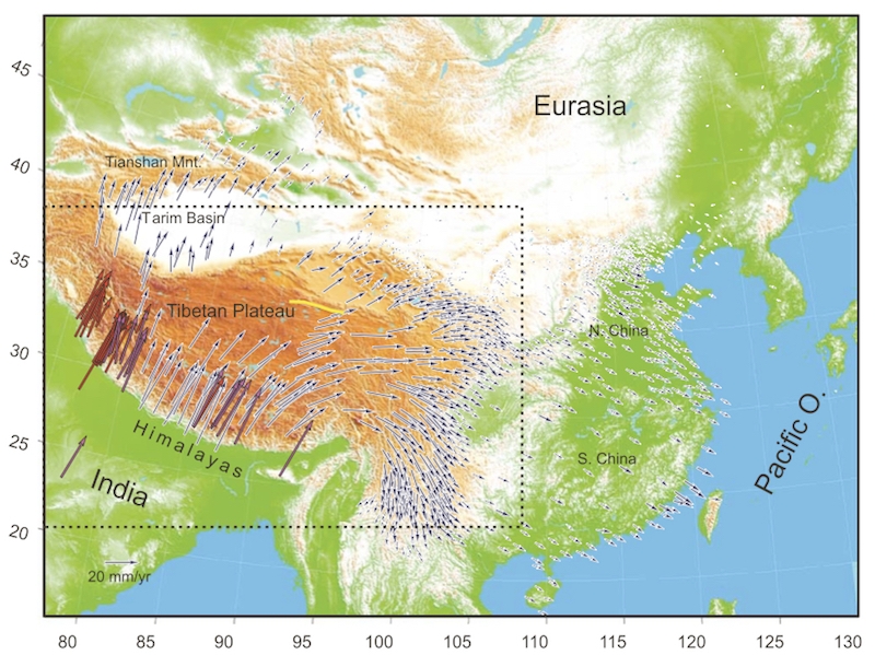
The arrows show the direction and speed of motion of GPS stations relative to the interior of Eurasia. India is moving to the northeast at about 4 centimetres a year. The arrows reduce in size as this motion is accommodated by faulting, and change direction where crust is being shoved out of the way rather than getting crumpled up. From Gan et al., 2007
Map of northern India and SW Asia, dotted with arrows showing the mostly north and east motion of the crust in the Himalayan collision zone relative to the interior of Eurasia.