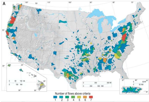
Watersheds with the top ~1% of annual peakflows in 100 years of USGS stream gaging records. (Figure 4a from O’Connor and Costa, 2004, Spatial distribution of the largest rainfall-runoff floods from basins between 2.6 and 26,000 km 2 in the United States and Puerto Rico, Water Resources Research, 40: W01107, doi:10.1029/2003WR002247) (paper not subject to copyright)
One recipe for flooding: Take a tropical cyclone and add steep topography

