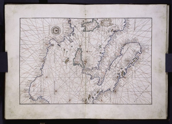
![]() There was a fascinating tidbit in one of the opening chapters of North Pole, South Pole that appealed to my inner map junkie. Many nautical charts from medieval times are criss-crossed with a network of lines which radiate outwards from selected points on the map.
There was a fascinating tidbit in one of the opening chapters of North Pole, South Pole that appealed to my inner map junkie. Many nautical charts from medieval times are criss-crossed with a network of lines which radiate outwards from selected points on the map.

Portolan map of the Central Mediterranean, dated to about 1550. Click to enlarge. Source: Digitial Scriptorium
It turns out the the sources of the radiating lines correspond to major seaports, and the lines themselves record the magnetic compass bearing to other ports in the region. Thus, to get from one port to another, all a navigator had to do was get the bearing off one of these ‘portolan’ (or ‘harbour finding’) maps and set a course along it. Pretty clever.
The disadvantage of this method, of course, is that you’re following a route without really knowing where you’re going, just as many people nowadays blindly follow the instructions of their GPS navigation software – sometimes into a teensy bit of trouble. However, given that this was centuries before a reliable and accurate method of estimating longitude was developed, the coastlines traced out by charts in this time may well have been of questionable accuracy. Perhaps it was a better bet to trust in the magnetic gods, and ‘sail along bearing 124 until you reach… coast’


Comments (1)
Links (1)-
Pingback: Mapas Portolano: GPS Medieval? « Blog do GPS