
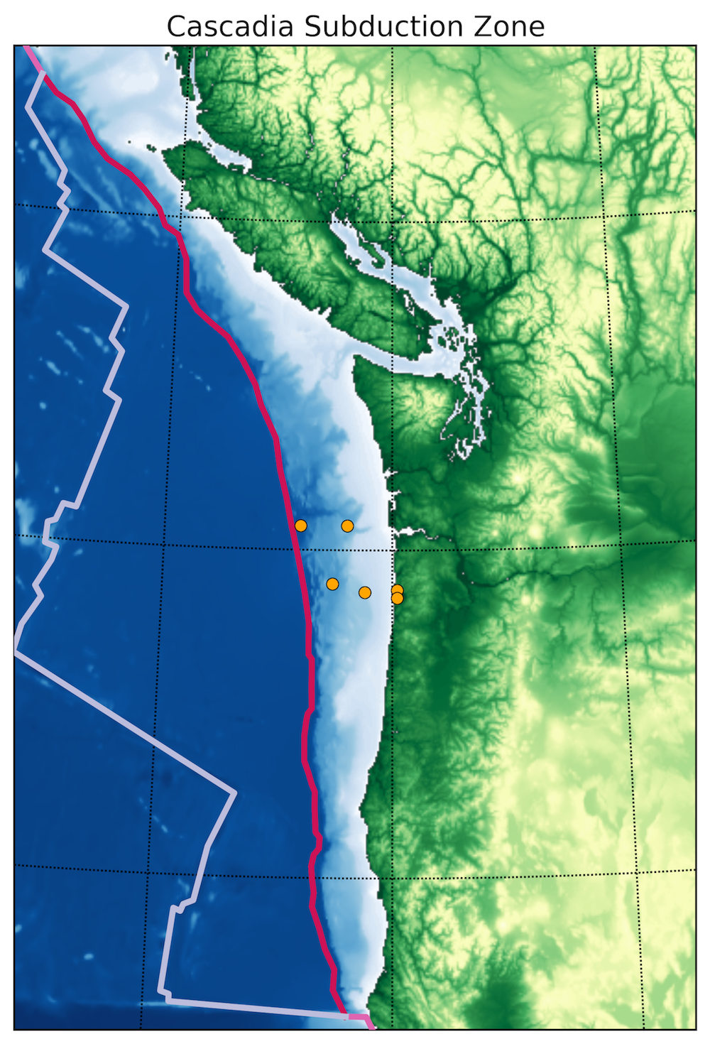
Chris: The Cascadia subduction zone (marked by the red line) can produce large magnitude 9 or more earthquakes that generate destructive tsunami, as it did when it last ruptured in 1700. It is particularly difficult to fully understand the ‘earthquake cycle’ of strain build up and release at subduction zones. On these massive, shallowly dipping faults the cycle lasts hundreds of years or more, whilst our record of deformation from GPS and other geodetic methods stretches back a mere decade or two. The orange circles show the location of marine sediment cores Chris has collected samples from to test a possible new method of extending the record of strain build-up across the subduction thrust much further back in time – over multiple earthquake cycles
The map is the result of Chris playing around with the ETOPO1 dataset in Python.