
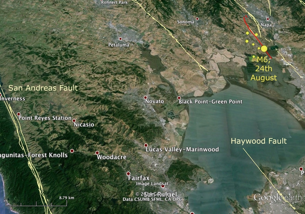
Location of Sunday’s earthquake relative to the San Andreas Fault. Yellow lines mark faults thought to have been active in the last 130,000 years, according to USGS mapping. The red line is the rough surface trace of Sunday’s rupture, as mapped by Mike Oskin’s speedy students, which appears to be associated with a previously unmapped strand of the West Napa Fault Zone.