
![]() We’ve been having one of those perfect spring weeks, where the weather is warm and sunny, the flowers are blooming, and there is nothing more enticing at the end of a workday than to take a nice long wander down by the local river. Fortunately, I can do that right from my front door – exploring the Cuyahoga River, as it flows through Kent. I’ve blogged a couple of times already about the Cuyahoga, but today I want to share some views that I couldn’t have shared 10 years ago, because they would have been underwater.
We’ve been having one of those perfect spring weeks, where the weather is warm and sunny, the flowers are blooming, and there is nothing more enticing at the end of a workday than to take a nice long wander down by the local river. Fortunately, I can do that right from my front door – exploring the Cuyahoga River, as it flows through Kent. I’ve blogged a couple of times already about the Cuyahoga, but today I want to share some views that I couldn’t have shared 10 years ago, because they would have been underwater.
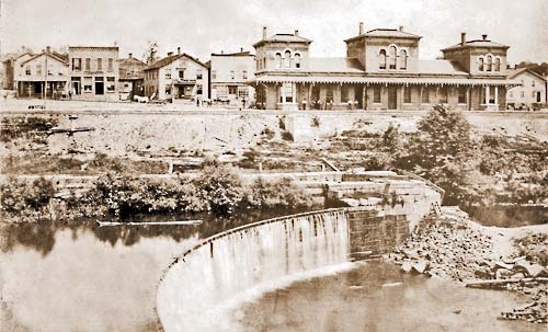
Kent Dam with canal lock and towpath behind it, in this undated photo from Kentohio.net
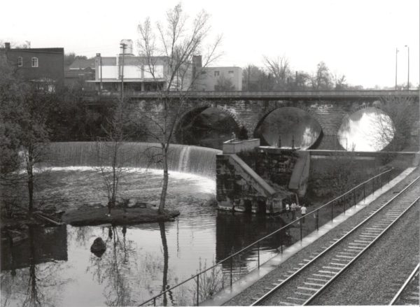
The dam as it appeared in 1971, as photographed by Jack Davis (via the Kent State University Special Collections and Archives). The canal lock had been destroyed by flooding in 1913 (apparently in rather spectacular fashion) and the wall at river left had been erected in its place.
For 168 years, a dam stood across the Cuyahoga River, under the main street bridge, and impounded water for a couple of miles upstream. In 2004, the dam was modified to let the river be free-flowing through town. The arched stone dam face was preserved but the remnants of a Pennsylvania and Ohio Canal lock structure were removed, creating a narrow chute in the river where once there was a full blockage. After the reservoir drained, some of the sediments were regraded to form a well-signed little heritage park behind the dam.
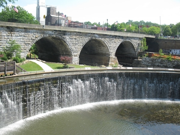
Looking upstream at the dam in August 2012. In the summer, water is recirculated to a trough at the top of the dam in order to give the illusion of a waterfall. On beautiful spring evenings, like this week, the park behind the dam is filled with people enjoying the weather…or studying.
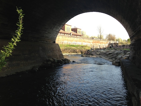
Looking downstream through an arch of the Main Street bridge at the remaining section of the dam on the right and the former lock, now river on the left. Photo April 30, 2013.
Above the dam site, the river is confined to a fairly narrow bedrock gorge with class 2 rapids. In a few places you can easily get down to it and see some nicely potholed rock in the riverbed. Kayakers call this a pin spot.
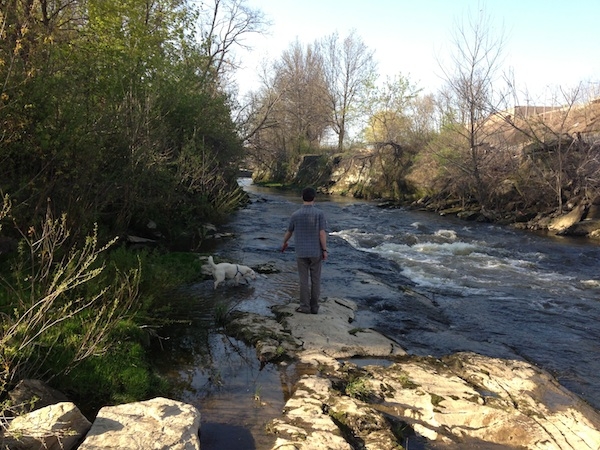
Looking upstream from the pin spot on the Cuyahoga in Kent. Co-blogger and the High Albedo geo-dog for scale.
While we were wandering down there a few evenings ago, we met an angler who caught and released two small trout from the river in the space of about five minutes. There was no fish passage around the Kent Dam before it was removed, so I’m taking the trout as a good sign of some ecological recovery in this section of the river. Another good ecological sign has been spotted a few miles downstream. Rebuilding of another bridge over the river in Kent has been delayed so that endangered native mussel beds can be relocated.
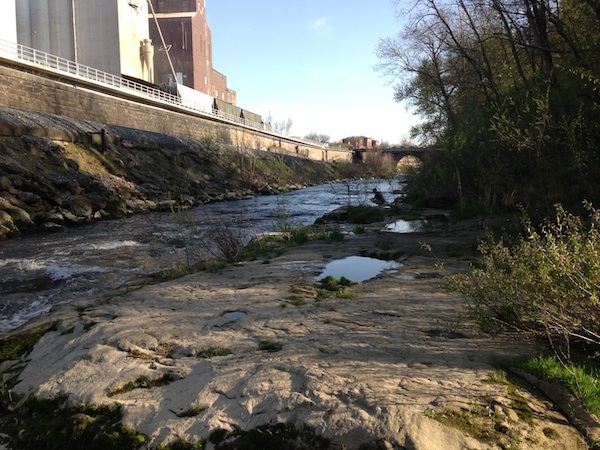
Looking downstream from the pin spot between Main St and Crain Ave. Look closely for the angler near the river.
I know that the dam removal decision in 2004 was controversial in the community – generations had grown up with the dam as a local landmark and it was on the National Register of Historic Places – but when I walk along this section of the river, I am impressed not only by the wonderful ecology and geomorphology of this little river that runs through our downtown, but I’m also impressed by the community’s embrace of the free-flowing Cuyahoga. On this day, so important to Kent’s history, it gives me hope that we can overcome the wrongs and divisions of the past and work together to make a better future for both our communities and the world around us.


Comments (2)
Links (1)-
Pingback: After the dam came out: The Cuyahoga River in Kent