
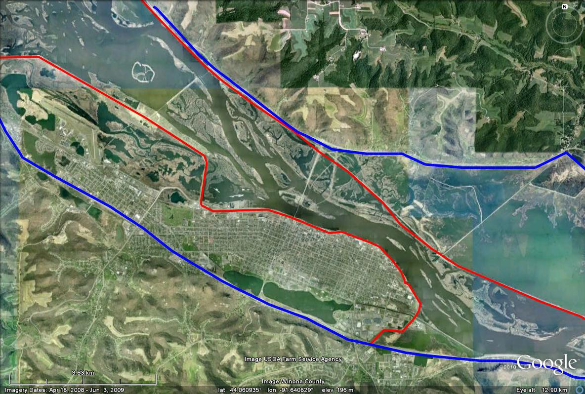
Winona is protected by levees, shown as red lines, and railroad dikes act as levees on the opposite side of the channel. The blue lines illustrate the approximate geomorphic extent of the floodplain. Above flood stage, the Upper Mississippi River has access to much less horizontal extent than it would naturally have, because of the levees. The magnitude of floodplain width reduction on the Lower Mississippi River is even more dramatic. (Image from Google Earth)