← Why does the Red River of the North have so many floods?
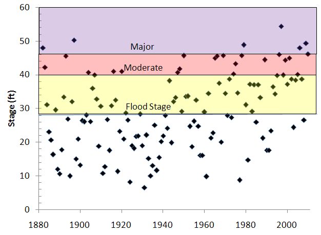
Annual peak stage on the Red River at Grand Forks, North Dakota. Data replotted from the USGS, with local NWS flood stages shown.
Your email address will not be published. Required fields are marked *
Name *
Email *
Website
Comment
You may use these HTML tags and attributes: <a href="" title=""> <abbr title=""> <acronym title=""> <b> <blockquote cite=""> <cite> <code> <del datetime=""> <em> <i> <q cite=""> <strike> <strong>
<a href="" title=""> <abbr title=""> <acronym title=""> <b> <blockquote cite=""> <cite> <code> <del datetime=""> <em> <i> <q cite=""> <strike> <strong>
Notify me of followup comments via e-mail