
![]() My regular readers are probably quite used to my occasional bouts of silence on this blog, but my low internet profile in the past fortnight has been for the quite justifiable reason that I was away on holiday. I had a blast, and unsurprisingly I quite blatantly indulged my inner geo-nerd when selecting my destination, which means several cool blog posts are in the pipeline. As a teaser, I give you the following two photos, and invite you to guess their geographical and geological provenance.
My regular readers are probably quite used to my occasional bouts of silence on this blog, but my low internet profile in the past fortnight has been for the quite justifiable reason that I was away on holiday. I had a blast, and unsurprisingly I quite blatantly indulged my inner geo-nerd when selecting my destination, which means several cool blog posts are in the pipeline. As a teaser, I give you the following two photos, and invite you to guess their geographical and geological provenance.
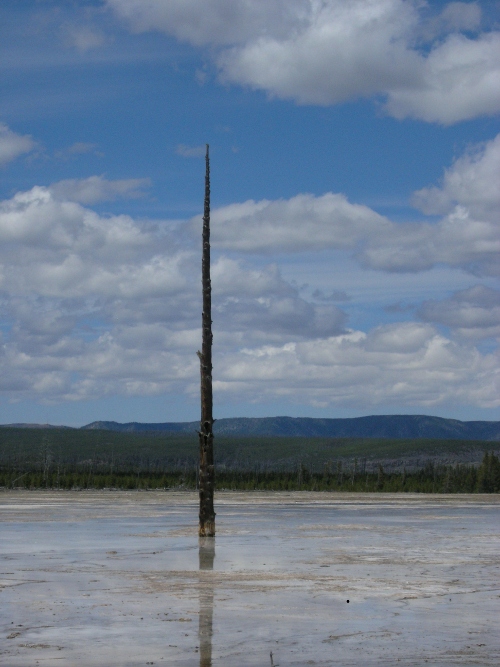
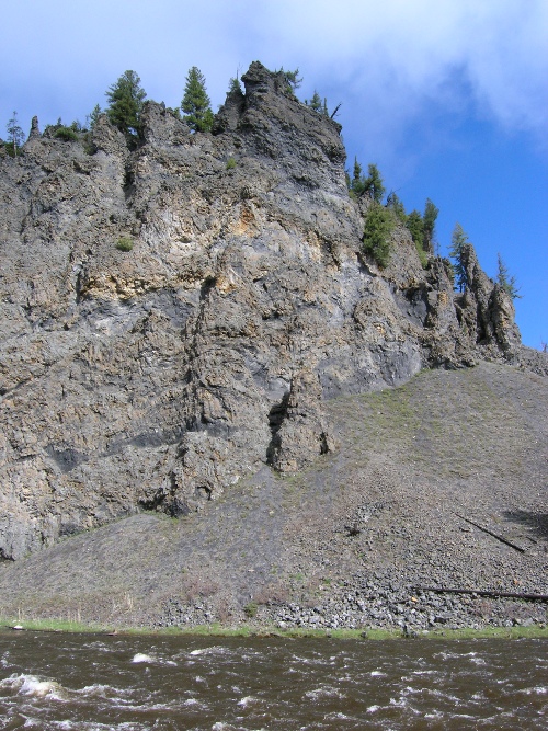
No prize in on offer save kudos for your geo-sleuthing skills, which will hopefully discourage those of you who communicate with me via other channels, and therefore already know where I’ve been hiding, from cheating. Guess away!
-
Archives
- September 2025
- July 2024
- March 2024
- January 2024
- October 2023
- August 2023
- July 2023
- May 2023
- March 2023
- February 2023
- December 2022
- November 2022
- September 2022
- July 2022
- May 2022
- November 2021
- October 2021
- September 2021
- August 2021
- August 2020
- July 2020
- May 2020
- April 2020
- March 2020
- January 2020
- December 2019
- August 2019
- March 2019
- February 2019
- January 2019
- June 2018
- May 2018
- February 2018
- January 2018
- December 2017
- October 2017
- September 2017
- August 2017
- March 2017
- February 2017
- January 2017
- December 2016
- October 2016
- September 2016
- August 2016
- May 2016
- March 2016
- December 2015
- November 2015
- September 2015
- August 2015
- May 2015
- March 2015
- February 2015
- January 2015
- December 2014
- November 2014
- October 2014
- September 2014
- August 2014
- July 2014
- June 2014
- May 2014
- March 2014
- February 2014
- January 2014
- December 2013
- November 2013
- October 2013
- September 2013
- August 2013
- July 2013
- June 2013
- May 2013
- April 2013
- March 2013
- February 2013
- January 2013
- December 2012
- November 2012
- October 2012
- September 2012
- August 2012
- July 2012
- June 2012
- May 2012
- March 2012
- February 2012
- January 2012
- December 2011
- November 2011
- October 2011
- September 2011
- August 2011
- July 2011
- June 2011
- May 2011
- April 2011
- March 2011
- February 2011
- January 2011
- December 2010
- November 2010
- October 2010
- September 2010
- August 2010
- July 2010
- June 2010
- May 2010
- April 2010
- March 2010
- February 2010
- January 2010
- December 2009
- November 2009
- October 2009
- September 2009
- August 2009
- July 2009
- June 2009
- May 2009
- April 2009
- March 2009
- February 2009
- January 2009
- December 2008
- November 2008
- October 2008
- September 2008
- August 2008
- July 2008
- June 2008
- May 2008
- April 2008
- March 2008
- February 2008
- January 2008
- December 2007
- November 2007
- October 2007
- September 2007
- August 2007
- July 2007
- June 2007
- May 2007
- April 2007
- March 2007
-
Meta
Comments (9)