
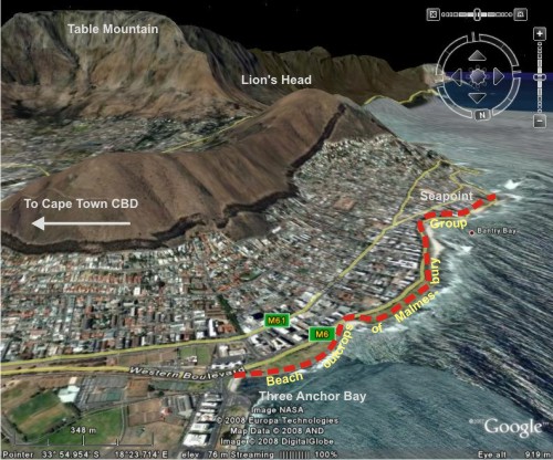
Before continuing from yesterday the account of my journey along the Capetonian seaside, I should probably adhere to the principle that good field geology starts with knowing where you are, and where you’re going. So, here’s a Google Earth view showing my southward route along the Atlantic coast to the west of the city centre, between Three Anchor Bay and Seapoint.
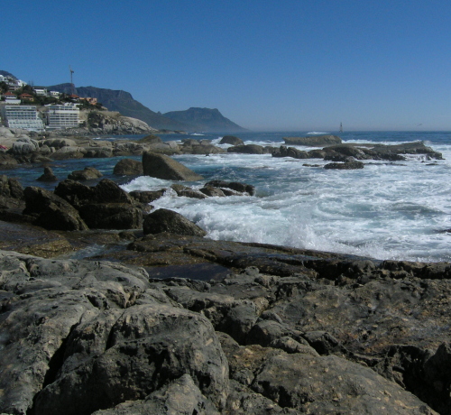
As I approached Seapoint, it was clear that I had also about to cross a contact between two rock units: looking ahead along the coast the clearly bedded and ridge-like outcrops of the Malmesbury Group were giving way to much more rounded outcrops of a massive looking, lighter coloured, lithology.
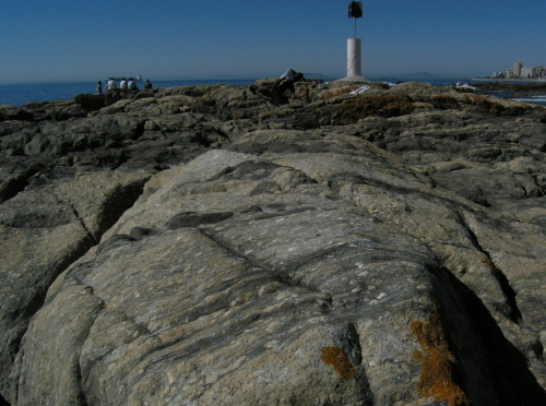
Before long, the rock beneath my feet was no longer interbedded sandstones and shales, but a course intrusive granite. This is part of the Cape Granite Suite, which has been dated to earliest Cambrian times – about 500-550 million years old. Here’s a photo taken looking back the other way, with the granite in the foreground and the Malmesbury group in the background (bonus points to those who spot something odd about this contact…)
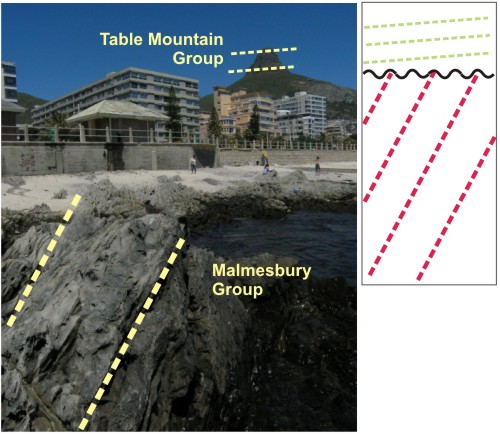
Although geologists do seem to spend disturbing amounts of time gazing at our feet, it’s useful to sometimes look up, if only to check if the mountains above you are made of the same stuff. In Cape Town, this is clearly not the case.
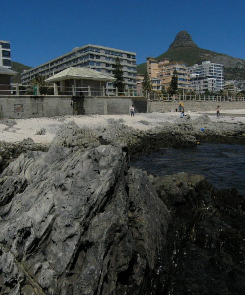
The top of Lions Head is composed of very shallowly-dipping sandstones of the lower Table Mountain Group, so-called because the iconic landmark itself is also formed from the same unit. The Cape Granite can be seen on the right part of the lower slope. Underlying the peak itself is the Malmesbury Group, which is also outcropping in the foreground of this on the beach where I took this photo. The fact that we have deformed and steeply dipping rocks overlain by flat-lying beds makes this a textbook angular uncomformity: the Malmesbury Group rocks were deposited, then tilted and eroded as a result of tectonic uplift, before the Table Mountain Group was deposited on top of them.
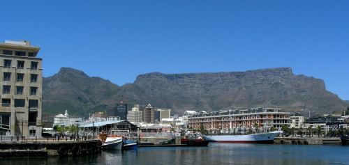
Later in the week, Jeanette and I did go for a jaunt to Table Mountain, but – rather typically – that day was the only day during my visit that it wasn’t looking like this.
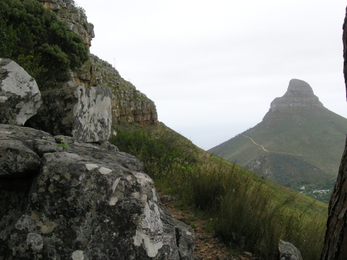
Instead, the clouds had moved in to hide the summit. But even without a view, there were still rocks we could look at, so we wandered up a trail to the base of the escarpment. That’s Lion’s Head in the background, with Seapoint being located on the far side.
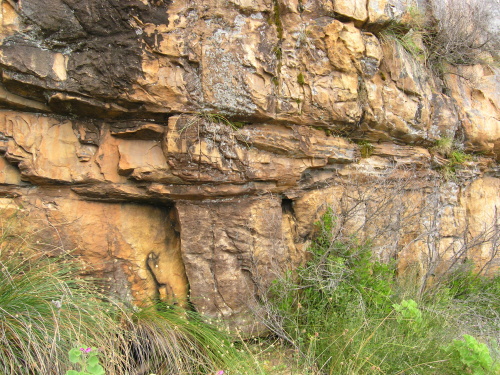
The path itself was paved with lots of chunks of the Table Mountain sandstones with cool sedimentary structures like ripples and cross-bedding. It was actually a tad harder to see these features in the actual outcrop, but once we got our eye in we could spot a fair number. Here’s a nice channel:
Non-geologists amongst you might be finding it pretty odd that I seem to have spent much of my non-conference time in Cape Town wandering around in search of rocks. But I did do other stuff, honest. In fact, I like cities where you can finish off a day’s geologising in a nice cafe, furnished with good coffee (or beer), good geoblogging company*, and a view.
*I really wish that I had a photo to emphasise this point, but it seems I was too busy enjoying the company to take any.


Comments (4)