
The picture below contains a very important boundary.
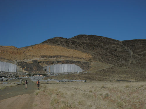
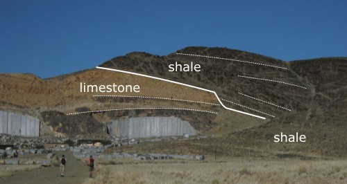
The boundary itself should be quite easy to spot, because Namibia is a country where the ‘remote sensing’ engaged in by lazy mapping students the world over might actually work properly; the contact between the more massively bedded white/yellow limestones on the left and the darker, thinly bedded shales on the right is almost 100% exposed. If we draw in the contact and a few representative beds (the dotted lines), we can see that it is not completely planar – there is a clear step about 2/3 of the way across the picture, against which shale beds are abruptly terminated against the limestone. This, and the appearance of some much stratigraphically lower shale beds in the foreground, is evidence of a slight uncomformity – the shale is filling in topography created by a period of erosion after deposition of the limestone beds.
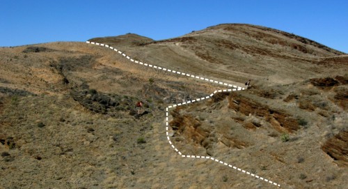
Over the other side of the hill, this uncomformity is even more obvious:
You wouldn’t drive all the way into the wilds of Namibia just to visit a minor erosional boundary, so why is this particular one so important? Both the limestones and the shales are part of the Nama Group, a sequence of limestones, sandstones and shales which were deposited between 500 and 600 million years ago, and one of the best records we have of the boundary between the Neoproterozoic and the Cambrian, and the emergence of animal life as we know it. Radiometric dating of an ash near the top of the limestone unit gives a date of 543.3 ± 1 million years, whilst an ash near the base of the shales gives an age of 539.4 ± 1 million years. The official age for the base of the Cambrian is 542 million years, so the boundary between the two units can essentially be treated as the base of the Cambrian, providing all sorts of opportunities for sad obsessives to attempt to pose dramatically.
The one fly in the ointment is the erosional nature of the contact – obviously there’s some missing time there, possibly as much as 5 million years, and it’s entirely possible that there are no 542 million year-old sediments preserved. However, that’s only a real problem if your notion of the ‘Cambrian Explosion’ is culled from creationist tracts, rather than reality. As the figure below, culled from one of my favourite ever Pharyngula posts, illustrates, the changes in the fossil record across the Cambrian boundary are gradual, as organisms slowly became larger, started producing biomineralised shells, and began to exploit ecological niches above and below the sediment surface.

The boundary itself, defined as the first appearance of a particular type of burrow, is just an arbitrary line drawn somewhere in the midst of this sequence of evolutionary changes. So, if (like my companions on this fieldtrip) you’re interested in the shifts in ocean chemistry or the configuration of the continents which accompanied the Cambrian radiation, the Nama Group represents an excellent record: it covers most of the relevant time period, has high deposition rates (it was deposited in a foreland basin associated with an episode of mountain building), and is itself relatively undeformed.
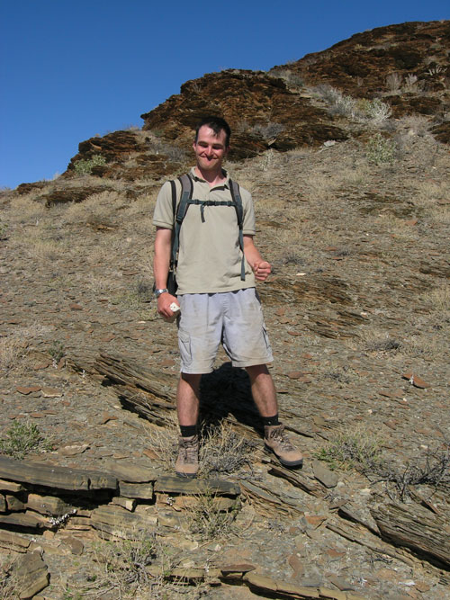
It does make the poser photo harder to justify, though.
Comments (12)